I created a web application that visualises road safety data in Taiwan cities. By using Kepler.gl, a powerful geospatial analytical tool, the traffic crash hot zones and peak time of day are identified.
I enjoyed this interesting side project very much. The data I used here is also shared in the app.
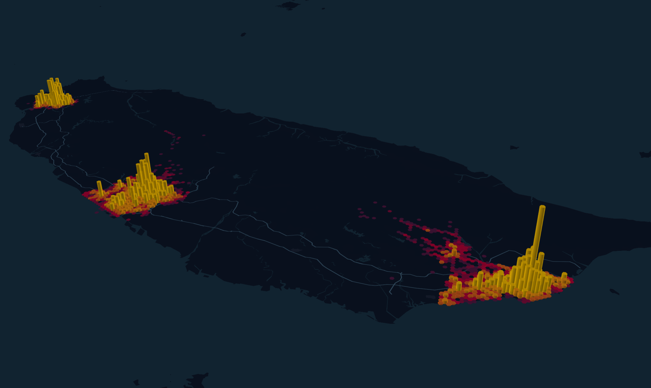
Source of road safety data: National Police Agency, Taiwan