Blog | ADU WORK IN PROGRESS
使用語言: JavaScript
工具、套件: Leaflet, DataTables
簡介:
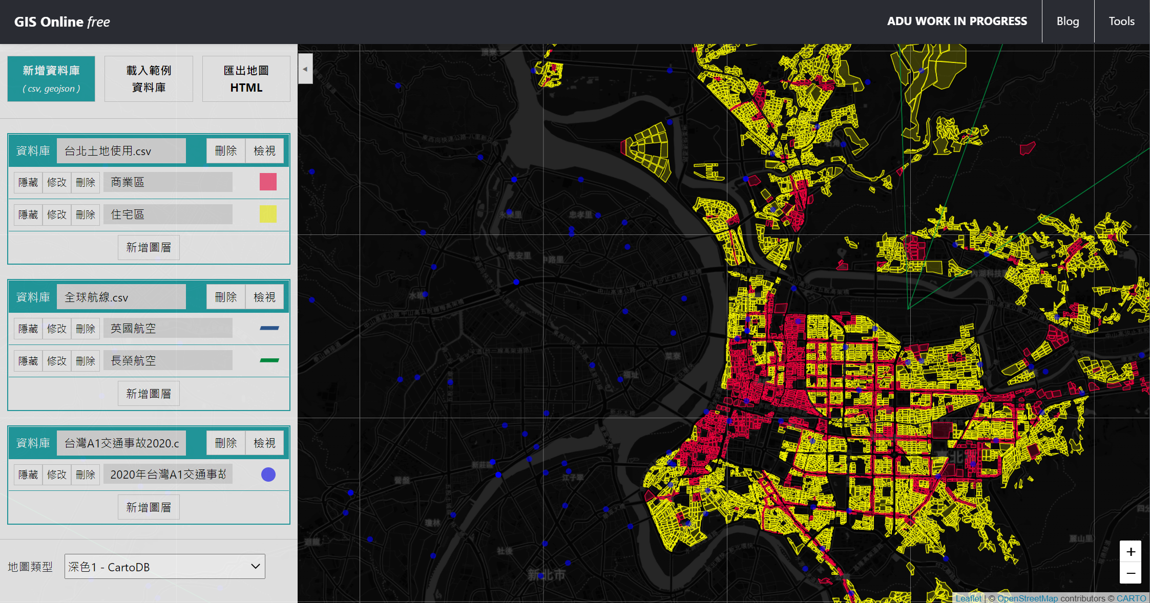
GIS Online 是免費的線上地圖資訊系統。使用者可自行上傳含有地圖空間資料之資料庫、自訂圖資呈現效果、最後匯出成果HTML檔案以供保存或分享。
PART IV-(2) OF THE REPRESENTATION AND MEASUREMENTS OF URBAN TRANSPORTATION NETWORKS
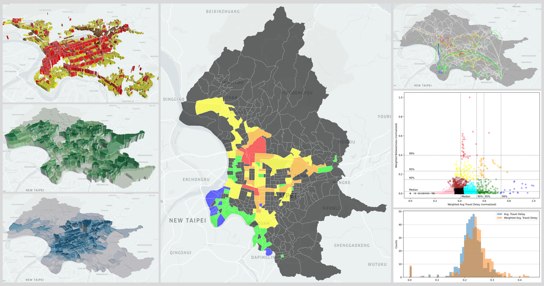
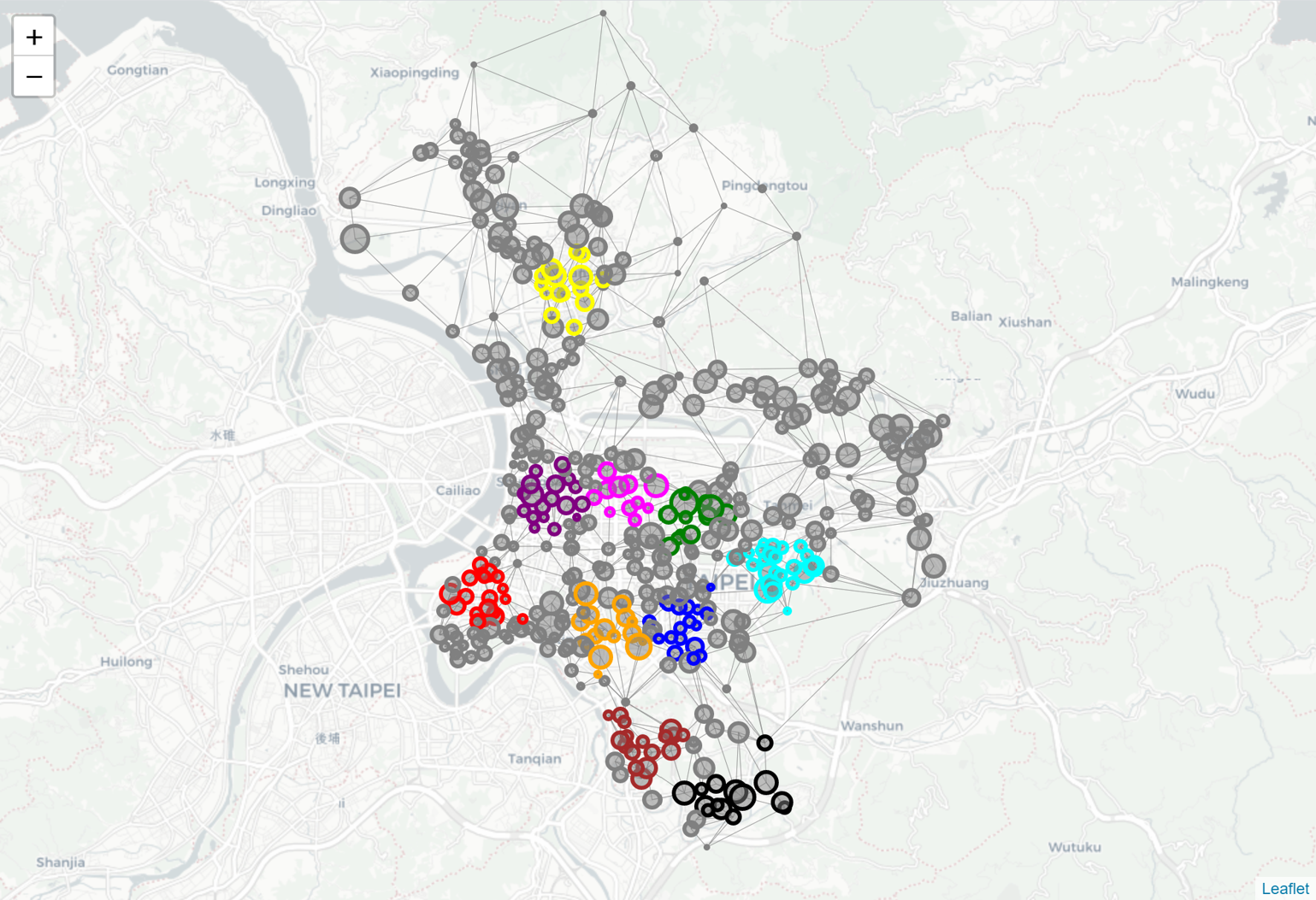
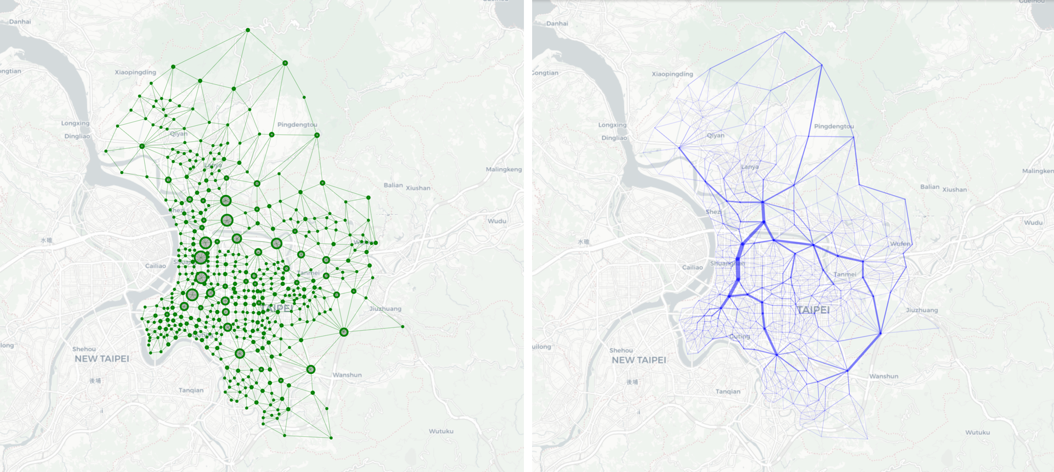
In the final post of this series of study, all key variables will be adjusted by the weights of nodes and integrated into the machine learning model. This post will conclude with the findings of key nodes/edges (among all 456 nodes and 2070 edges in the network) which shall have the top priority for improvement or investment in transportation infrastructure.
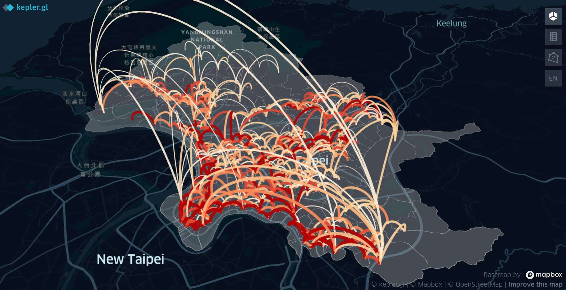
使用語言: JavaScript
工具、套件: kepler.gl
簡介:
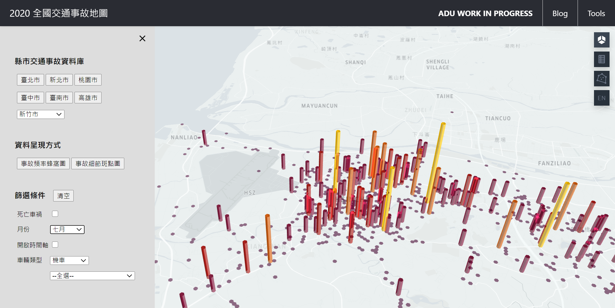
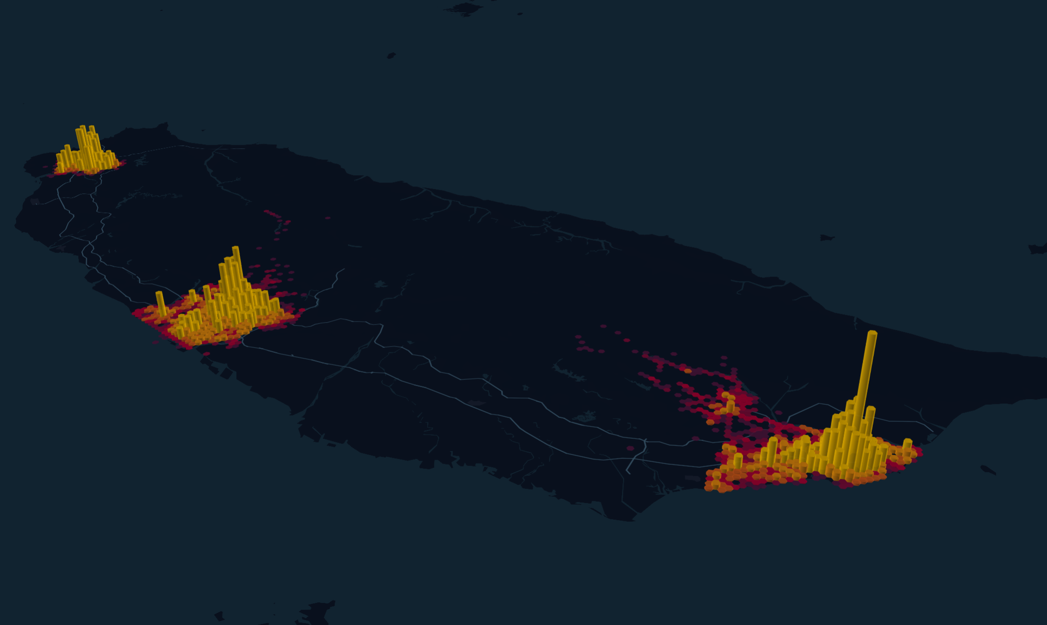
將2020年台灣各縣市交通事故資料視覺化,快速定位交通事故熱區,並建立篩選器搜尋符合條件之資料分布。
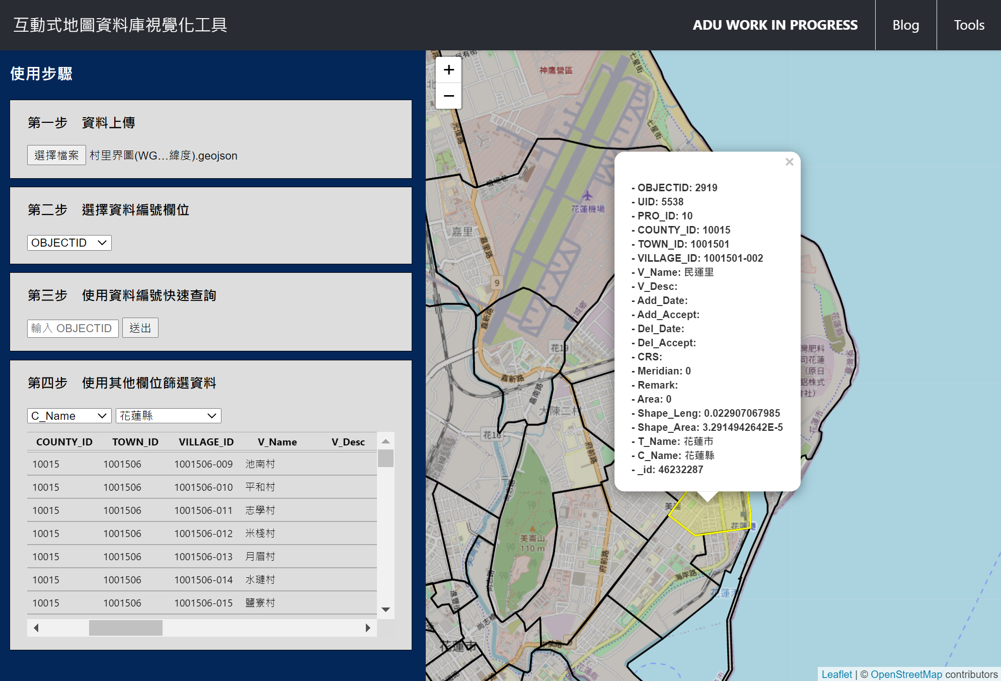
使用語言: JavaScript
工具、套件: Leaflet
簡介:
使用者自行上傳地理圖資資料,藉由此互動式工具快速對照資料庫資訊與地理空間資訊。
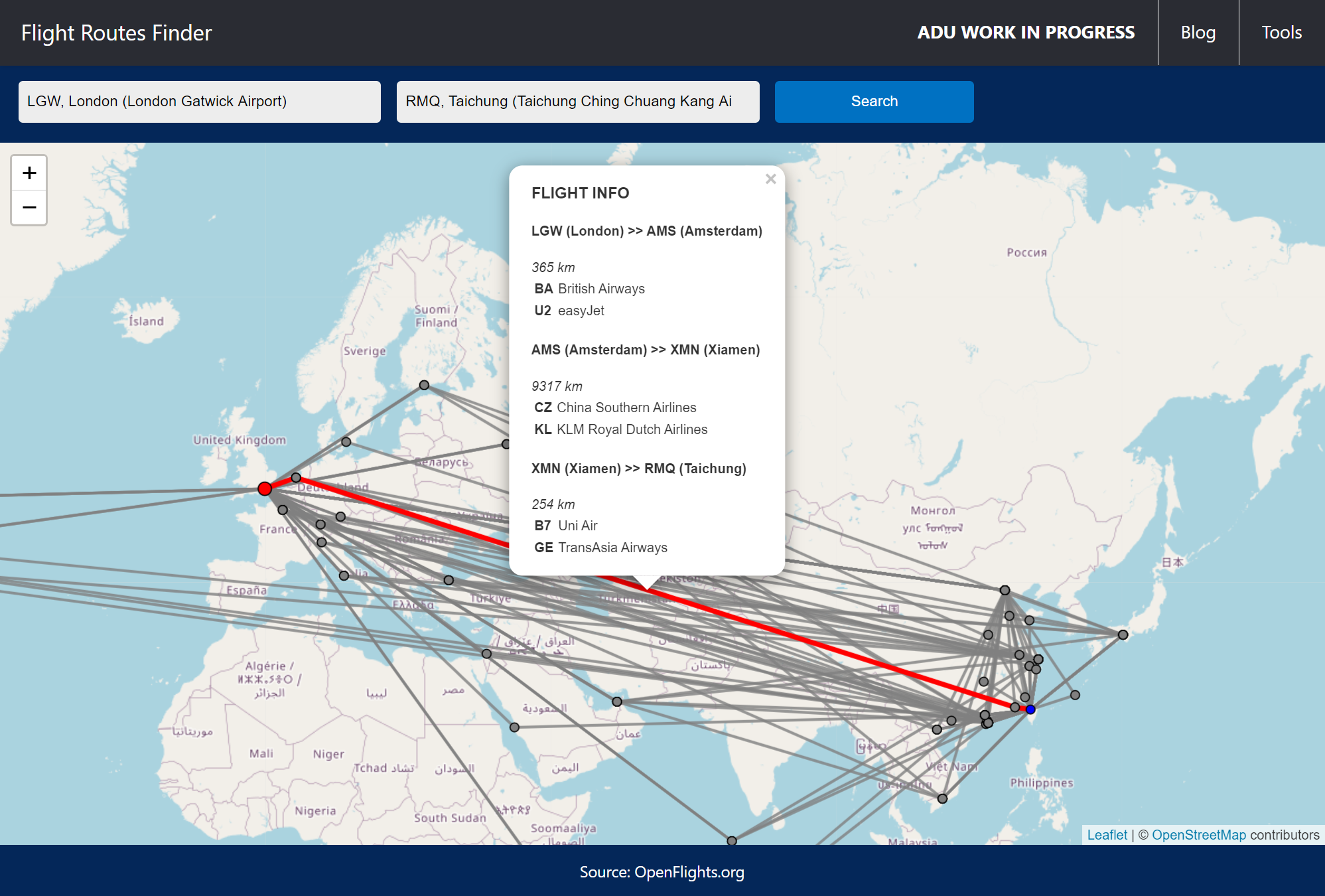
使用語言: JavaScript, Python
工具、套件: Leaflet
資料來源: OpenFlights
簡介:
簡單輸入起訖地機場,即可查詢兩點間所有理論上存在的航線(最多中轉兩次)。
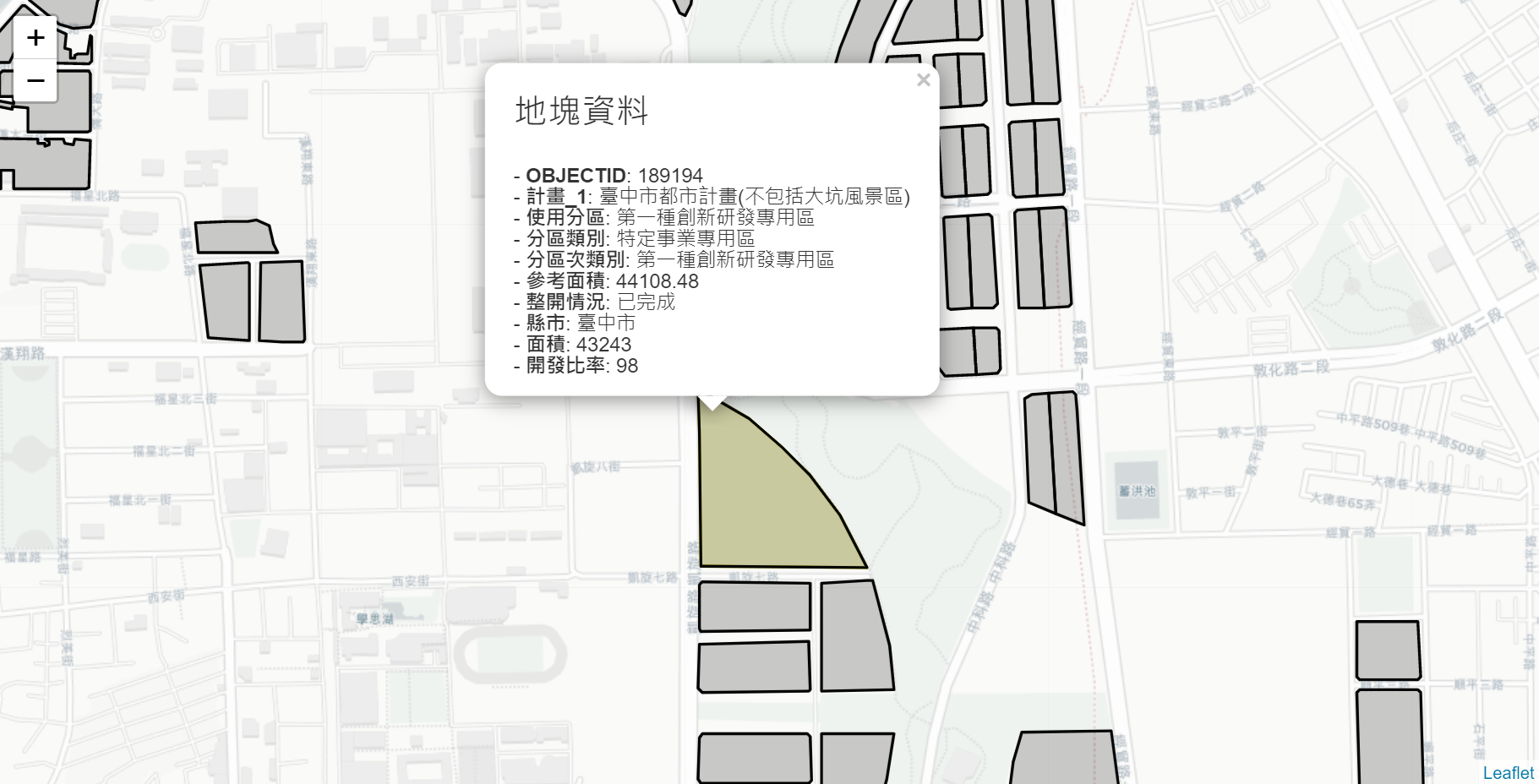
使用語言: Python, JavaScript
工具、套件: Folium
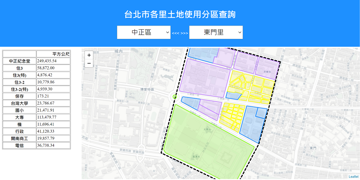
資料來源: 委託方提供
需求: 輸入都市計畫特定專用區地塊的 ObjectID 以快速查詢該地塊資料,包含以地圖顯示位置、使用分區、面積、開發情況等。
PART IV-(1) OF THE REPRESENTATION AND MEASUREMENTS OF URBAN TRANSPORTATION NETWORKS
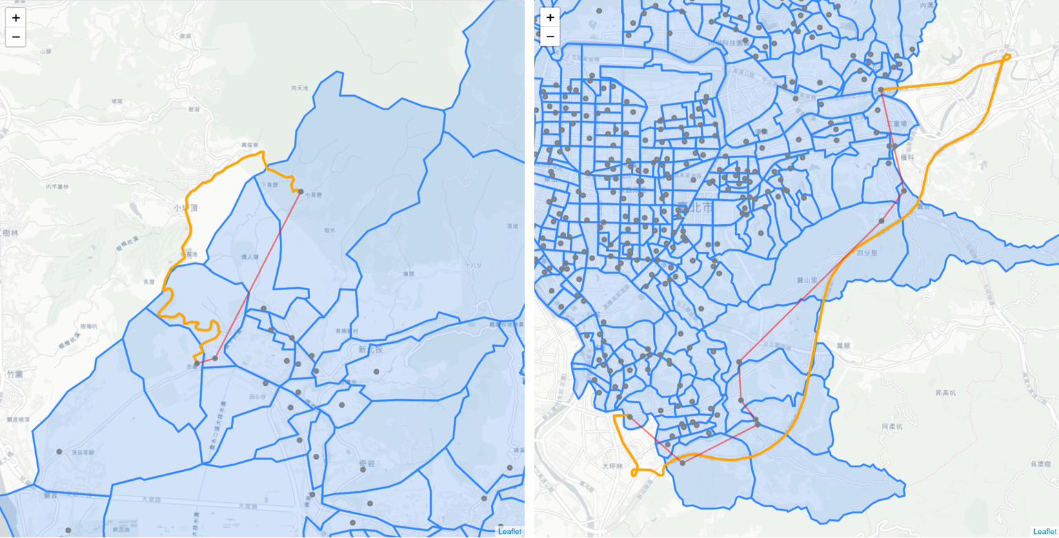
The travel-time delay of all 207,936 routes, 456 villages and 2,070 edges within the network of the City is calculated, visualized and discussed. This post identifies the villages as well as the edges with relatively bad traffic condition during morning peak time.
I created a web application that visualises road safety data in Taiwan cities. By using Kepler.gl, a powerful geospatial analytical tool, the traffic crash hot zones and peak time of day are identified.
I enjoyed this interesting side project very much. The data I used here is also shared in the app.
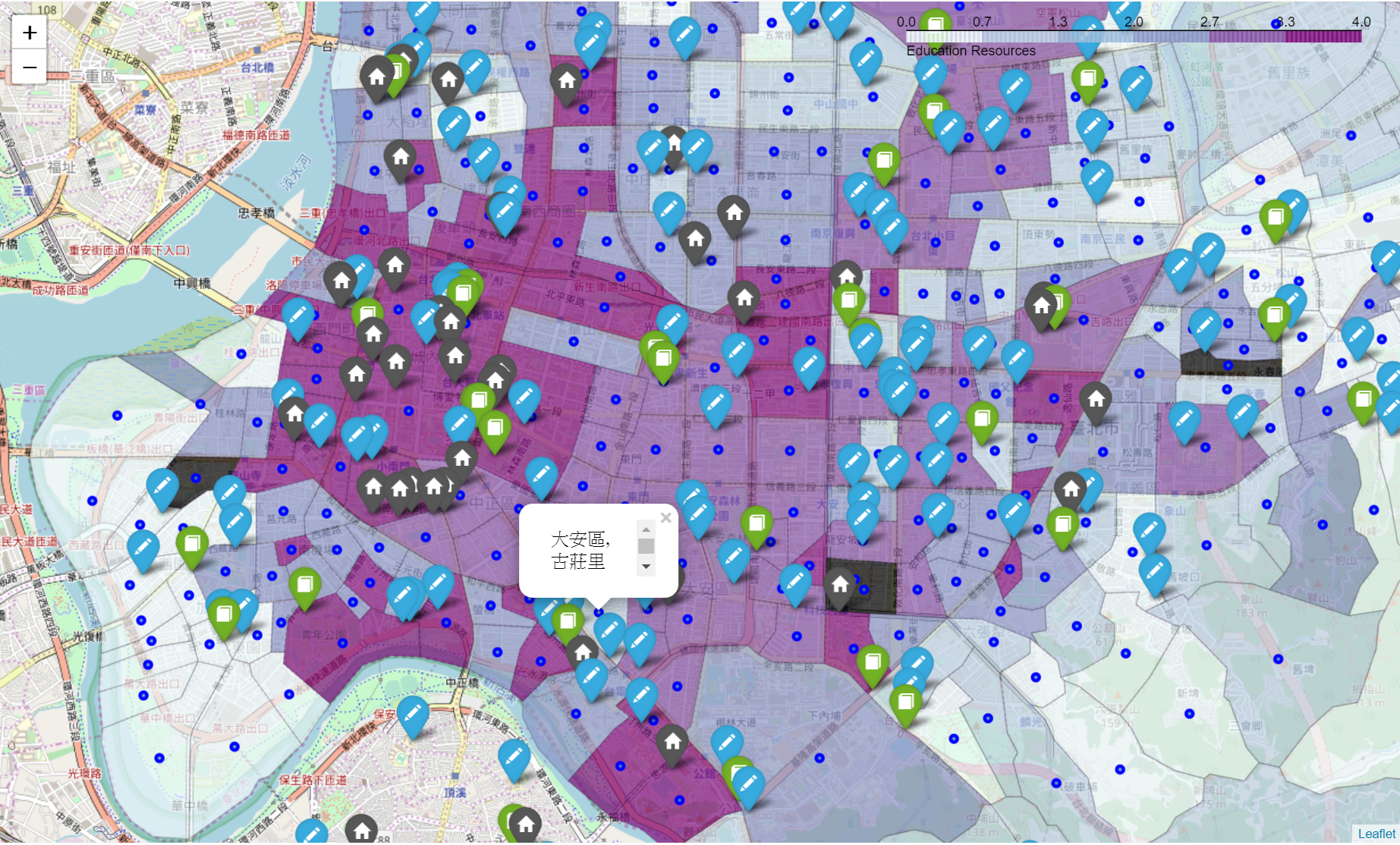
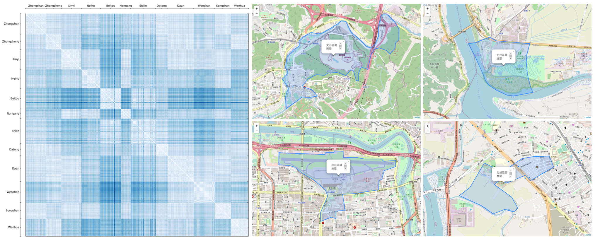
I’ve been working on research of Taipei transportation for weeks and recently require the land area of each land use of all villages. The search engine by the government is not designed for searching by administrative geo-space, nor does the public data provides such stats. As a result I decide to put things together by myself, and open to anyone who’s interested.
PART III-(2) OF THE REPRESENTATION AND MEASUREMENTS OF URBAN TRANSPORTATION NETWORKS
In this post I examine the betweenness centrality of 456 nodes and 2070 edges in the real world transportation network, and identify the potential high-risk traffic zones. Unlike closeness centrality which represents the accessibility of the nodes, betweenness measures the probability of the nodes/edges being used while travelling in the City. In other words, when a node/edge with high betweenness score is removed (blocked), a great number of routes will be affected.
PART III-(1) OF THE REPRESENTATION AND MEASUREMENTS OF URBAN TRANSPORTATION NETWORKS
This post first examines Closeness Centrality of the real-world network, and points out potentially highest accessible villages in the City. Though not widely covered in any studies, nodes’ weight is also taken into consideration to look at the service coverage problem. The groups of villages that cover a certain amount of population within a given travel time are then identified.
PART II OF THE REPRESENTATION AND MEASUREMENTS OF URBAN TRANSPORTATION NETWORKS
To better simulate the real world, this post reviews, defines and assigns the weights and directions to the network. The Geocoding API by Google Maps Platform as well as HERE Routing API are used to acquire the travel data.
PART I OF THE REPRESENTATION AND MEASUREMENTS OF URBAN TRANSPORTATION NETWORKS
Transportation modeling is at the core of urban transportation planning process. It attempts to simulate human behavior of travelling, estimates the impact of traffic on existing transportation networks, and provides reference for future infrastructure improvement, such as new roads or change of public transit system, for the next decades.
This is the Capstone project I’ve done for the learning of IBM Data Science. I had great fun in the field of data science and applying them to the research topic that I’m interested in!